E
4:30 h
13 km
810
7
THE HIKE
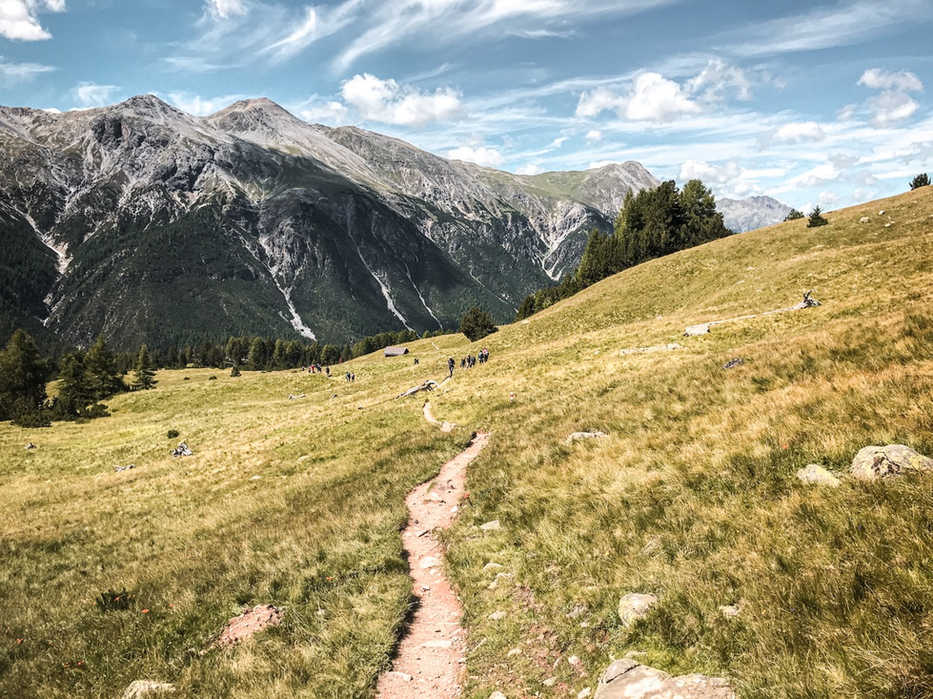
When the Alp la Schera house was built, the dam of Lake Livigno probably did not yet exist, and the lake with it - the view from Alp la Schera was therefore limited to an incredible but "empty" valley, cloaked in fir trees. Today, however, from the alp you can enjoy a spectacular view of the straight lake of Livigno, almost perfectly straight in front of us. And since we are in relatively remote valleys, at Alp la Schera you will find particularly few people and an unreal peace.
We start walking from the P5 car park (1795 m) which we find on the fun road that connects Zernez to Val Venosta. If you arrive from Livigno, remember to check the opening hours and costs of the Munt la Schera tunnel.
We are already at a very high altitude, which makes this excursion particularly suitable for sultry days. The path immediately enters a fairy-tale forest - it is not for nothing that we are in the Swiss National Park - and we go up it on a constant slope until we finally emerge in the large and panoramic pasture of Alp la Schera (2091 m, 1 hour). A single house punctuates it, with a new bench and a small fountain.
You can already stop here, in this dazzling and quiet pasture, with a view of Lake Livigno - and with a telescope, you can look for herds of deer on the opposite side of the valley.
For even broader views we can instead reach the summit of Munt la Schera, a large grassy hump with a lunar feel, 500 meters higher (approximately 2580 m, 1.30 hours for the ascent, 1 hour for the descent). Return to the car along the same route (40 minutes).
If you want to extend the tour a little, from Munt la Schera you can opt for a long circular tour continuing eastwards along the panoramic ridge of Munt la Schera, then descending into the valley to Buffalora (1970 m), and then walking along the valley floor in slight descent for about 6km along the state road until returning to P5 where we left the car.
MAP
PHOTO GALLERY
HIKES IN THE SAME REGION
EQUIPMENT
The mountains are a dangerous environment: make sure you always have the right equipment — hiking or trail shoes, warm clothes and waterproofs in case of unexpected changes in weather conditions, a small emergency kit.
I've made an Amazon "shopping note" to make sure you have everything — ps if you buy from these links, 3% goes to support the development and maintenance of Hikes of the World 🙏.
-
Breathable t-shirt ( example )
-
Sweatshirt, fleece, or light jacket
-
Waterproof windbreaker (for example: men / women )
-
Gloves and hat (you never know)
-
Backpack with rain cover
-
Trekking poles (not essential, but they help to unload the weight of the backpack and ease the impact on the joints)
-
Trekking or trail running shoes (in great vogue lately because they are lightweight. These Salomon ones - for men and women - are an excellent entry-level, preferably Gore-Tex)
-
For via ferratas: complete via ferrata kit (I have this one , very light and compact, with this harness and helmet — or you can buy complete kits ). Buy in store to receive ad hoc support
-
To sleep a night in a refuge: sheet or light sleeping bag
-
Water bottle or thermos
-
Light crampons if you think you will find ice or snow on the route
-
Power bank or cell phone charger
-
Camera
-
Drone, for those who love to "fly" (used in moderation and at a distance from other people. I have had the DJI Mini 2 for over 2 years and have found myself very happy with it. The DJI Mini 3 also allows you to take vertical photographs)
-
Small emergency kit ( example )
-
Sun cream (essential)
-
Sunglasses


